A digital map refers to a virtual representation of the game world that provides situational awareness and navigation assistance to players. These digital maps are typically accessible a thought game electronic device such as MicroDAGR or military tablets or smart phones running ATAK or tv screen in briefing rooms.
Using the electronic device, players can interact with the digital map interface to zoom in and out, set waypoints, measure distances, and view various layers of information.
Players have the ability to add markers from a predefined set that is specific to their army affiliation, whether it be NATO or Russian. These markers are designed to represent various important locations, objectives, or tactical elements relevant to their faction. By utilizing these pre-defined markers, players can enhance their communication, coordination, and situational awareness within the game.
Players can utilize stylus pen to draw shapes and lines directly on the digital map device. This functionality allows for precise and detailed markings, enabling players to highlight areas of interest, designate routes, or create tactical diagrams. By using stylus pens, players can enhance their strategic planning and communication during gameplay.
Digital markers and drawings in the game can contain additional data, including the date and time of creation, the author's name, the channel they were created for (such as platoon, squad, vehicle, command, or user-defined channels), and text descriptions. This extra information enhances the context and relevance of the markers and drawings, enabling better coordination, communication, and strategic decision-making within the game. By incorporating these data points, players can gain a more comprehensive understanding of the information displayed on the digital map and effectively utilize the markers and drawings during gameplay.
In addition to using a pin on the map, players have the option to add markers by manually entering coordinates or distance and bearing from the player
Players can choose to automatically share the markers, shapes, and lines they draw on the digital map with their squad or platoon through device communication channels, provided that the communication system is enabled and not jammed. This feature allows for real-time sharing of tactical information, promoting efficient coordination and situational awareness among team members. However, if the communication system is disabled or experiencing interference, the automatic sharing functionality may be affected, requiring alternative means of communication.
If a player manages to gain access to an enemy device, whether it belongs to an NPC or another human player, and successfully unlocks it, they may not only have access to the markers and shapes already shared by the enemies but also to the markers that are yet to be shared. This gives the player the ability to intercept and gather valuable real-time intelligence on the enemy's intentions, movements, and planned actions. By leveraging this information, players can make strategic decisions and adapt their own tactics accordingly, potentially turning the tide of battle in their favor.
The Game Master, also known as Zeus, has the capability to add digital markers and drawings into NPC devices. This feature allows the Game Master to enhance the gameplay experience by providing visual cues, mission-specific details, or strategic insights through the manipulation of NPC devices. By incorporating digital markers and drawings, the Game Master can guide players, highlight objectives, or introduce new elements to the game world. This dynamic and interactive feature adds depth, immersion, and a sense of realism to the gameplay, creating a more engaging and captivating experience for both players and the Game Master.
The player has the advantage of a real-time marker displaying their own location on the digital map if the GPS service is available and not jammed. This feature provides crucial situational awareness, allowing the player to accurately track their position, coordinate with teammates, and make informed tactical decisions based on their current location. By having access to real-time GPS data, players can effectively navigate the game world, maintain situational awareness, and strategically engage in combat or complete mission objectives.
In addition to the real-time marker for the player's own location, the game can incorporate a Blue Force Tracker (BFT) feature. The BFT system enables players to track and identify friendly forces on the digital map in real-time. It provides a visual representation of allied units' positions, enhancing coordination and communication among teammates. With the BFT feature, players can easily identify the locations of friendly forces, monitor their movements, and effectively plan and execute joint operations. This feature promotes teamwork, reduces the risk of friendly fire incidents, and improves overall situational awareness for players within the game.
The Blue Force Tracker (BFT) feature relies on units equipped with GPS-enabled devices, such as tablets or MicroDAGR, that can transmit their real-time location information. As long as the GPS signals are not disrupted or jammed and others choose to share their location , these devices provide continuous updates of friendly forces' positions on the digital map. This feature enhances coordination, situational awareness, and tactical decision-making by providing accurate and up-to-date information about the locations of teammates in the game.
The digital map can provide real-time location tracking of designated targets equipped with tracker devices, whether they are individuals or vehicles. This feature allows players to view the live positions of tracked targets on the map, enhancing situational awareness and enabling strategic decision-making based on the movements and positions of these targets. By incorporating real-time tracking, players can effectively coordinate their actions, monitor enemy movements, and respond tactically to changing situations within the game.
Additionally, players can utilize tools on the digital map to measure various parameters between two points, such as distance, bearing, and elevation. This functionality allows for accurate calculations and precise planning during missions. Players can measure the distance between two locations to determine travel times, evaluate potential firing ranges, or assess the feasibility of certain routes. The ability to measure bearings helps in navigation and targeting, enabling players to determine the direction and angle of movement or engagement. Elevation measurements provide information about height differentials, which can be crucial for identifying advantageous positions, determining line of sight, or planning artillery fire. By incorporating these measurement capabilities into the digital map, players can make informed decisions and strategize more effectively during gameplay.
The digital map should incorporates various interactive features to enhance the gameplay experience. It includes digital zoom functionality, allowing players to zoom in and out of the map to explore different areas and analyze details more closely. Additionally, players can click on specific points on the map to obtain valuable information such as the elevation from sea level, the coordinates of the point, as well as the distance and bearing from the player's current location to the selected point. These features provide players with comprehensive situational awareness, enabling them to make informed decisions, plan strategic movements, and effectively coordinate with teammates. By integrating these digital elements into the map, the game creates a more immersive and realistic military simulation, replicating the tools and capabilities utilized by real-world military personnel.
Players have the ability to connect digital binoculars, such as the Vector 21, and laser designators to the device that contains the digital map. This integration allows for advanced marker creation using these devices. By utilizing the digital binoculars, players can gather precise information about enemy positions, distances, and other tactical details. They can then use the laser designator to designate targets or specific locations on the map. The device with the digital map can detect and interpret the data from these connected devices, automatically generating markers with relevant information. This feature enhances situational awareness, coordination, and target acquisition in the game. Players can leverage real-world military technology to improve their strategic decision-making and effectively communicate critical information to their team.

above is example device running digital map on ATAK attached to vest

above is example device that contains digital map [R10IP8M-RTT2ML]
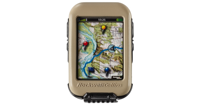
above is example of other device that contains digital map [Rockwell Collins MicroDAGR GPS receiver]
Defect
3 years ago
A digital map refers to a virtual representation of the game world that provides situational awareness and navigation assistance to players. These digital maps are typically accessible a thought game electronic device such as MicroDAGR or military tablets or smart phones running ATAK or tv screen in briefing rooms.
Using the electronic device, players can interact with the digital map interface to zoom in and out, set waypoints, measure distances, and view various layers of information.
Players have the ability to add markers from a predefined set that is specific to their army affiliation, whether it be NATO or Russian. These markers are designed to represent various important locations, objectives, or tactical elements relevant to their faction. By utilizing these pre-defined markers, players can enhance their communication, coordination, and situational awareness within the game.
Players can utilize stylus pen to draw shapes and lines directly on the digital map device. This functionality allows for precise and detailed markings, enabling players to highlight areas of interest, designate routes, or create tactical diagrams. By using stylus pens, players can enhance their strategic planning and communication during gameplay.
Digital markers and drawings in the game can contain additional data, including the date and time of creation, the author's name, the channel they were created for (such as platoon, squad, vehicle, command, or user-defined channels), and text descriptions. This extra information enhances the context and relevance of the markers and drawings, enabling better coordination, communication, and strategic decision-making within the game. By incorporating these data points, players can gain a more comprehensive understanding of the information displayed on the digital map and effectively utilize the markers and drawings during gameplay.
In addition to using a pin on the map, players have the option to add markers by manually entering coordinates or distance and bearing from the player
Players can choose to automatically share the markers, shapes, and lines they draw on the digital map with their squad or platoon through device communication channels, provided that the communication system is enabled and not jammed. This feature allows for real-time sharing of tactical information, promoting efficient coordination and situational awareness among team members. However, if the communication system is disabled or experiencing interference, the automatic sharing functionality may be affected, requiring alternative means of communication.
If a player manages to gain access to an enemy device, whether it belongs to an NPC or another human player, and successfully unlocks it, they may not only have access to the markers and shapes already shared by the enemies but also to the markers that are yet to be shared. This gives the player the ability to intercept and gather valuable real-time intelligence on the enemy's intentions, movements, and planned actions. By leveraging this information, players can make strategic decisions and adapt their own tactics accordingly, potentially turning the tide of battle in their favor.
The Game Master, also known as Zeus, has the capability to add digital markers and drawings into NPC devices. This feature allows the Game Master to enhance the gameplay experience by providing visual cues, mission-specific details, or strategic insights through the manipulation of NPC devices. By incorporating digital markers and drawings, the Game Master can guide players, highlight objectives, or introduce new elements to the game world. This dynamic and interactive feature adds depth, immersion, and a sense of realism to the gameplay, creating a more engaging and captivating experience for both players and the Game Master.
The player has the advantage of a real-time marker displaying their own location on the digital map if the GPS service is available and not jammed. This feature provides crucial situational awareness, allowing the player to accurately track their position, coordinate with teammates, and make informed tactical decisions based on their current location. By having access to real-time GPS data, players can effectively navigate the game world, maintain situational awareness, and strategically engage in combat or complete mission objectives.
In addition to the real-time marker for the player's own location, the game can incorporate a Blue Force Tracker (BFT) feature. The BFT system enables players to track and identify friendly forces on the digital map in real-time. It provides a visual representation of allied units' positions, enhancing coordination and communication among teammates. With the BFT feature, players can easily identify the locations of friendly forces, monitor their movements, and effectively plan and execute joint operations. This feature promotes teamwork, reduces the risk of friendly fire incidents, and improves overall situational awareness for players within the game.
The Blue Force Tracker (BFT) feature relies on units equipped with GPS-enabled devices, such as tablets or MicroDAGR, that can transmit their real-time location information. As long as the GPS signals are not disrupted or jammed and others choose to share their location , these devices provide continuous updates of friendly forces' positions on the digital map. This feature enhances coordination, situational awareness, and tactical decision-making by providing accurate and up-to-date information about the locations of teammates in the game.
The digital map can provide real-time location tracking of designated targets equipped with tracker devices, whether they are individuals or vehicles. This feature allows players to view the live positions of tracked targets on the map, enhancing situational awareness and enabling strategic decision-making based on the movements and positions of these targets. By incorporating real-time tracking, players can effectively coordinate their actions, monitor enemy movements, and respond tactically to changing situations within the game.
Additionally, players can utilize tools on the digital map to measure various parameters between two points, such as distance, bearing, and elevation. This functionality allows for accurate calculations and precise planning during missions. Players can measure the distance between two locations to determine travel times, evaluate potential firing ranges, or assess the feasibility of certain routes. The ability to measure bearings helps in navigation and targeting, enabling players to determine the direction and angle of movement or engagement. Elevation measurements provide information about height differentials, which can be crucial for identifying advantageous positions, determining line of sight, or planning artillery fire. By incorporating these measurement capabilities into the digital map, players can make informed decisions and strategize more effectively during gameplay.
The digital map should incorporates various interactive features to enhance the gameplay experience. It includes digital zoom functionality, allowing players to zoom in and out of the map to explore different areas and analyze details more closely. Additionally, players can click on specific points on the map to obtain valuable information such as the elevation from sea level, the coordinates of the point, as well as the distance and bearing from the player's current location to the selected point. These features provide players with comprehensive situational awareness, enabling them to make informed decisions, plan strategic movements, and effectively coordinate with teammates. By integrating these digital elements into the map, the game creates a more immersive and realistic military simulation, replicating the tools and capabilities utilized by real-world military personnel.
Players have the ability to connect digital binoculars, such as the Vector 21, and laser designators to the device that contains the digital map. This integration allows for advanced marker creation using these devices. By utilizing the digital binoculars, players can gather precise information about enemy positions, distances, and other tactical details. They can then use the laser designator to designate targets or specific locations on the map. The device with the digital map can detect and interpret the data from these connected devices, automatically generating markers with relevant information. This feature enhances situational awareness, coordination, and target acquisition in the game. Players can leverage real-world military technology to improve their strategic decision-making and effectively communicate critical information to their team.
above is example device running digital map on ATAK attached to vest
above is example device that contains digital map [R10IP8M-RTT2ML]
above is example of other device that contains digital map [Rockwell Collins MicroDAGR GPS receiver]